EXPOSED: The Secrets Of Corsham & Rudloe Manor
By Matt Scofield
April 14, 2018
April 14, 2018
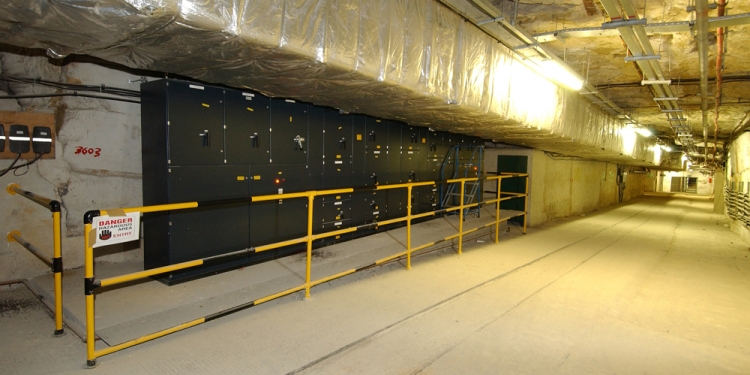
Photo: Crown Copyright

Photo: Crown Copyright
This page is more than seven years old and was last updated in September 2022.
The Rudloe Manor site in Corsham in Wiltshire has become quite a mecca for military historians, urban explorers and conspiracy theorist, and it's no surprise. The whole area is home to several active and decommissioned bases, most of which were at some point shrouded in secrecy, a few of them still are.
What makes the Rudloe area even more interesting is what is hidden beneath it. Around 60 miles of tunnels spread over a two mile wide, 270 acre site. Most of the underground complex is made up of three mammoth former stone quarries, which date back to around 1840. They are the mighty Box Quarry, Tunnel Quarry and Spring Quarry. The whole site is split through the middle by Isambard Kingdom Brunel's Box Tunnel, which carries the main railway line to London.
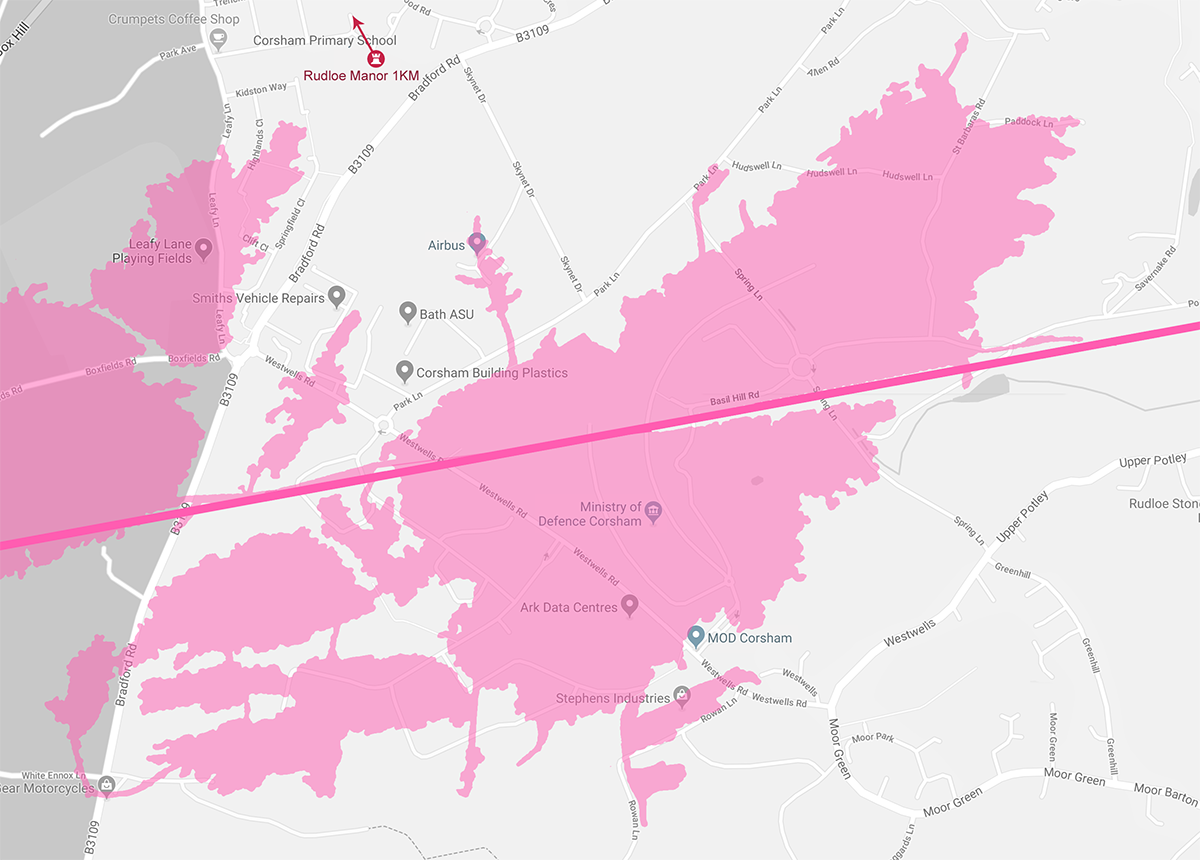
Rudloe Manor shot to fame in the mid-90s when rumours leaked that the base was where the Royal Air Force dealt with reports of unidentified flying objects. This was later confirmed in 2010 when documents were released under the Freedom of Information Act that stated that until the early part of 1992 the Flying Complaints Flight (FCF) was based at Rudloe Manor.
This department was the central co-ordination point for reports of UFOs made to RAF stations around the country by members of the public. Rudloe Manor's role was to record details of UFO reports and pass them on to the Secretariat (Air Staff) 2 in Whitehall where the reports where then checked for evidence that the UK Air Defence Region might have been compromised by hostile activity.
With rumours of government officials collecting UFO reports and stories of secrets tunnels, conspiracy theorist assumed that FCF must be based in an ultra secret underground bunker. However the department was actually based in an unglamorous, prefabricated office building on the grounds of the manor house.
Several other office buildings existed on the site, including the headquarters of the Provost and Security Services, which provided security vetting for many government departments perhaps including the MI5 and MI6. This led to the base being described as the British equivalent of Area 51 and the highest point of security in the UK.
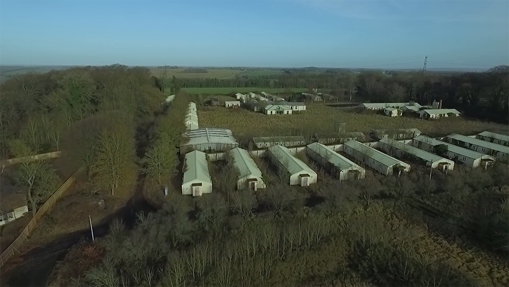
Photo: youtube.com
So, if UFOs weren't investigated under Rudloe Manor, what was? Well, nothing. Although Rudloe Manor has a reputation for its secret underground tunnels, in reality the manor house is actually almost a kilometre away from the Ministry of Defence's subterranean network. The reason for the misconception is that the manor house and its surrounding prefab office buildings made up a now decommissioned RAF base, which took its name from the manor.
The manor house was located in RAF Rudloe Manor Site 1. Just down the road was Site 2, which was also part of RAF Rudloe Manor and it's here, behind the high barbed wire fences and security gates, that ominous buildings hide secret entrances to the vast network of tunnels below.
At around the same time as Site 1 was shut down in the 90s, Site 2 became home to the Global Operations Security Control Centre (GOSCC). It acts as the central communications hub for all of the UK's military, operating from a new £690 million, modern glass-fronted building on Westwells Road, as well as underground server rooms in Tunnel Quarry beneath. However, most of Rudloe's Site 2 is sat on top of Spring Quarry.
Spring Quarry
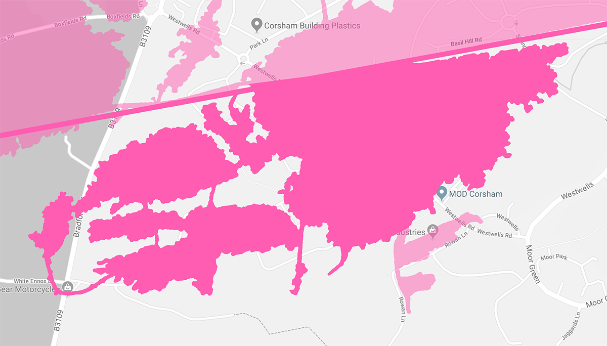
With the Second World War approaching, the Ministry of Aircraft Production took over Spring Quarry, which lies to the south of Box Tunnel, from the Bath and Portland Stone Company. They had been extracting building stone from the quarry for the last century. In 1941, work started to convert the 2.25 million square-foot site into the world's largest underground factory.
Known at the time as the Beaverbrook underground aircraft factory, it became a safe place for workers from the Bristol Aerospace Company, the BSA Barrel Mill Company and the Parnell Turret Company to continue making aircraft parts which were vital to the war effort. An area of the quarry in the north-west was intended for use by Dowty Engineering, but it was never completed.
After the war the factory was passed over to the Royal Navy, who used some of the underground caverns for storage until the 1990s.
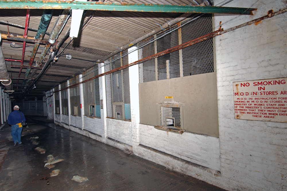
Photo: Crown Copyright
One area of Spring Quarry has been Grade II listed for its historic interest and uniqueness. The area, known as the Quarry Operations Centre (QOC), houses murals by local artist Olga Lehmann, which were painted onto the walls using nothing but paints from the aircraft factory to brighten up a large underground canteen area for factory workers.
Since the late-90s, urban explorers have pushed their luck by trying to gain access to Spring Quarry. Fortunately, most of the entrances to the quarry are on MOD property and have been kept secure by base staff. However a couple of weak points have been exploited over the years.
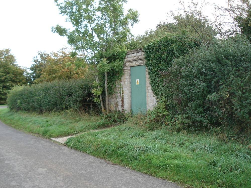
One such weak point was a small brick building, which sits discreetly on White Ennox lane. Inside this innocuous building is a stair well, which spirals 30 meters down into the quarry. The stairs were a designated emergency exit from the aircraft factory and the shaft also provided an access point for services such as gas and electric.
After several break ins, which included the metal grills of the ventilation panels being cut and breeze blocks being removed, the building is now very secure. Today it looks impenetrable, it is probably alarmed, the bushes around the building have been cut back to improve visibility for the MOD police on their regular patrols along the country lane. Not to mention the fact that the rusting stairwell is now potentially deadly.
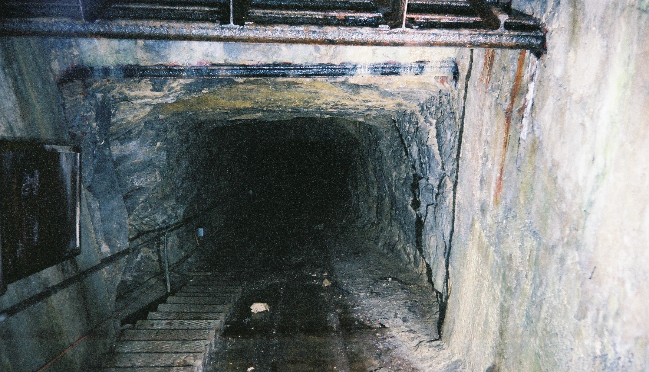
Another infiltration point was in the south of Spring Quarry via a much smaller, adjoining Sands Quarry.
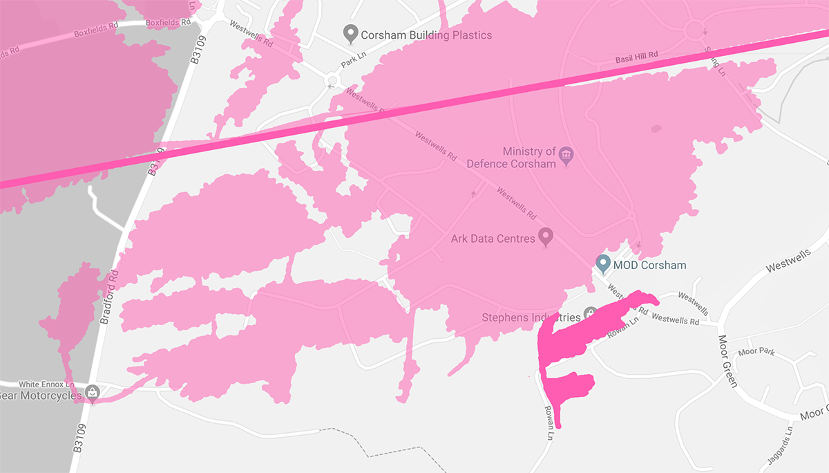
Sands is a fairly small quarry, it is only about 4.6 square miles. The Bath and Portland Stone company started quarrying Bath stone here in 1890. Quarrying stopped in 1912 and the quarry had very little use since this date.
Sands was never converted by the War Department, but it was requisitioned. An emergency escape route was established through the old stone workings, with reflective metal checkpoints to guide the way from Spring Quarry to the surface slope shaft of Sands Quarry, lit only by a torch light.
The quarry is no longer used as an emergency exit. Today two walls separate Sands from Spring Quarry, and the surface entrance, which is located outside of the MOD's perimeter fences in a small wooded area just off of Westwells Road, has been securely welded shut and fenced off to keep out unwanted guests.
The reason for the increased security around Spring is because of the quarry's newest tenant, Ark. The secure data storage company's Spring Park is based on Westwells Road on a former plot of MOD land, but they also own one million square foot of underground tunnels in the western end of Spring Quarry.
Not much is known about the current uses of the underground area, but Ark said they planned to use the space as server rooms to provide robust and secure data storage for the government and enterprise. Ark say that their underground space combined with their 38 acres of above ground data storage, gives them the potential to build Europe's largest "data reservoir."
Keeping servers underground not only makes the service very secure, but it also makes it one of the most sustainable and environmentally friendly of its kind in the world, due to the reduce need for cooling. As well as commercial contracts, Ark handles data centre services for the MOD.
But, despite all this security, television presenter Phillip Schofield managed to get into the site in 2015. So, that's what's been going on in the western end of Spring Quarry since WWII, but what about the eastern end of the quarry? Well, this area has been hiding an even bigger secret.
Advertisement ‐ Content Continues Below.
Burlington
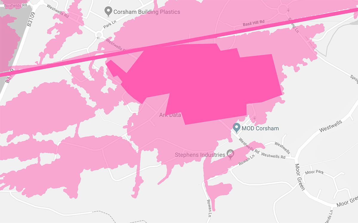
Burlington Bunker has been described as the holy grail of urban exploration and its origins are routed in the Cold War. With the threat of nuclear attack from the soviets looming, the British government began work to strengthen and secure an area of Spring Quarry.
The site was completed in 1961 and became the wartime seat of power in the event of a nuclear strike on the UK, housing the Prime Minister, cabinet office, local and national government agencies, intelligence and security advisors and domestic support staff.
The Government, once safely inside Burlington, could run the country as normal with help from the Prime Minister's map room. The bunker's primary role was to act as a hub and maintain communications within the UK and with the outside world, there was a huge telephone exchange to keep them in touch with various parts of the country.
Throughout the years, Burlington went by several different codenames, including the Hawthorn Central Government War Headquarters, the Emergency Government War Headquarters (EGWHQ), Stockwell, Subterfuge, Turnstile, and more recently Site 3, a reference to Rudloe sites 1 and 2.
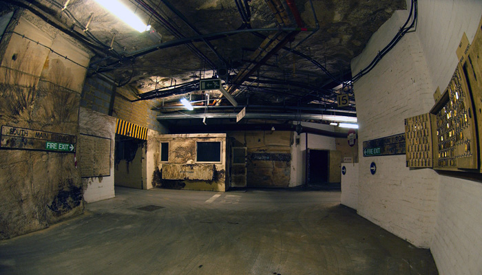
Photo: Crown Copyright
Burlington had everything the inhabitants would need to survive over a sustained period of time, including an infirmary with examination rooms, wards and a dental surgery. There were also two large kitchens with a bakery, and a laundry, which was said to be the biggest in Europe at the time.
The bunker also housed a well stocked library containing a small but important collection of books with which the devastated country could be rebuilt. This included maps, scientific and technical manuals and acts of Parliament.
The nuclear hideout had dedicated accommodation for the Prime Minister. Despite their importance the room set a side for the PM was the same as the other staff accommodation in the complex, except that the walls had been whitewashed and the room had its own private bathroom, which included a bath.
Access to the bunker was via several goods lifts, passenger lifts and two escalators which provided pedestrian access. The most well known entry point to Burlington is Passenger Lift 2 (PL2). The pair of unique wooden lifts have been out of service for decades, but the top of the lift shaft and entrance can be seen just inside the MOD's perimeter fence at the side of Westwells Road.
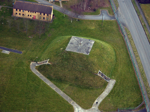
Photo: Crown Copyright
Burlington was kept stocked and on standby until the 1980s when, due to the diminished threat from Russia, the bunker was no longer deemed to be of strategic importance and was decommissioned, having never seen action. The MOD finally admitted the existence of the bunker in 2004, when it was declassified.
There are several prevalent myths about Burlington bunker. These rumours include claims that the bunker had its own nuclear generator, that there was an underground pub called the Red Lion, and that the bunker had its own underground railway station. Although these rumours are untrue, there is a subterranean station in Corsham, but its not in Burlington.
A private branch line at the eastern end of Box Tunnel on the main train line from London darts underground at Corsham, but the line serves Tunnel Quarry, to the north of Burlington. In fact, the reason it took the MOD so long to declassify Burlington was because for more than a decade its role was as a decoy site, detracting attention away from the secrets hidden in neighbouring Tunnel Quarry.
Tunnel Quarry
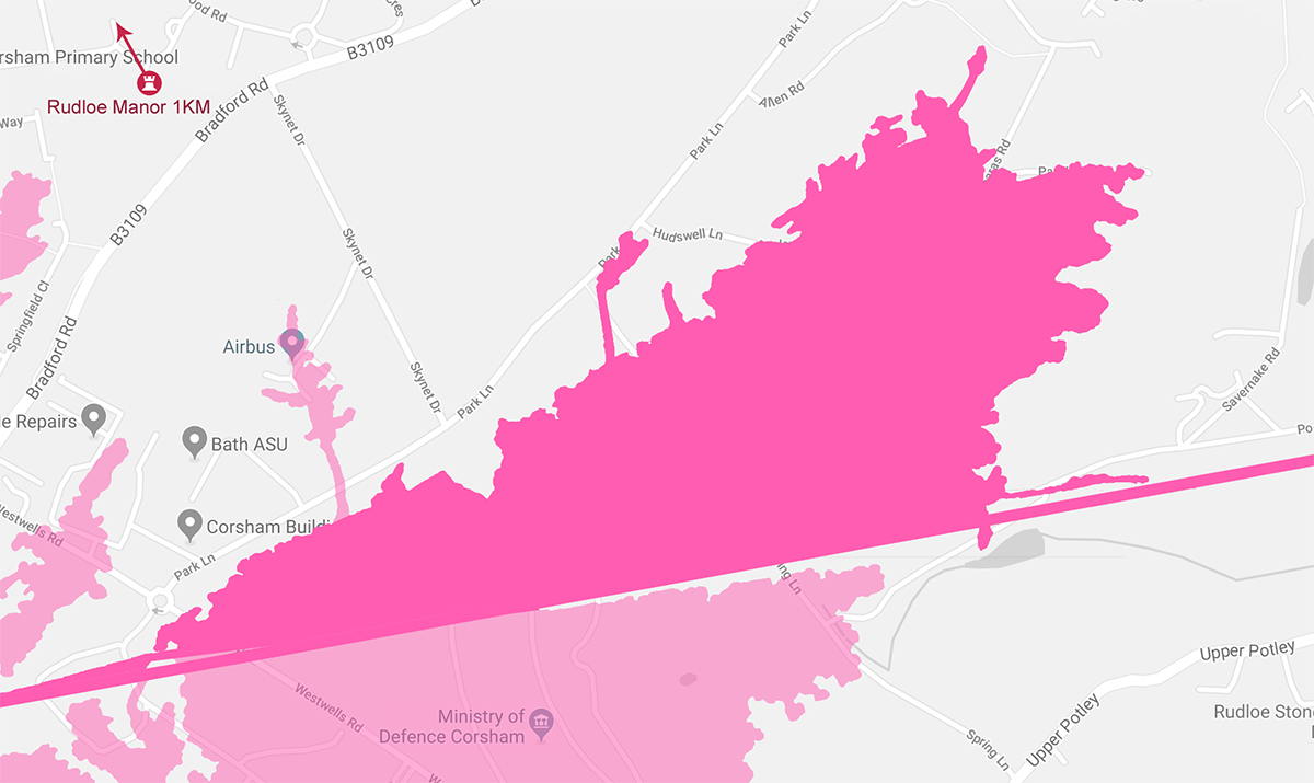
Tunnel Quarry, located to the north of Box Tunnel, was converted as a sub-depot of the Central Ammunition Depot, with other depots spread across the wider area at Monkton Farleigh, Neston and Gastard. The four depots had a total capacity to store 350,000 tons of ammunition, which was vital to our efforts during WWII.
The extensive conversion work involved constructing regular storage bays, creating a flat and even floor, installing air conditioning and lighting. New slope shafts were dug into the quarry to facilitate the movement of ammunition, at surface level these shafts came together in the Main Surface Loading Platform (MSLP). The unique hexagon shaped room gave access to all four shafts.
The ammo store was also served by a half-mile long underground railway station. It consisted of two platforms which were accessible via a branch line from the main London to Bristol railway line. The ammunition could be unloaded underground, safe from German bombs, and moved in to storage in one of the sub-depot's ten storage districts.
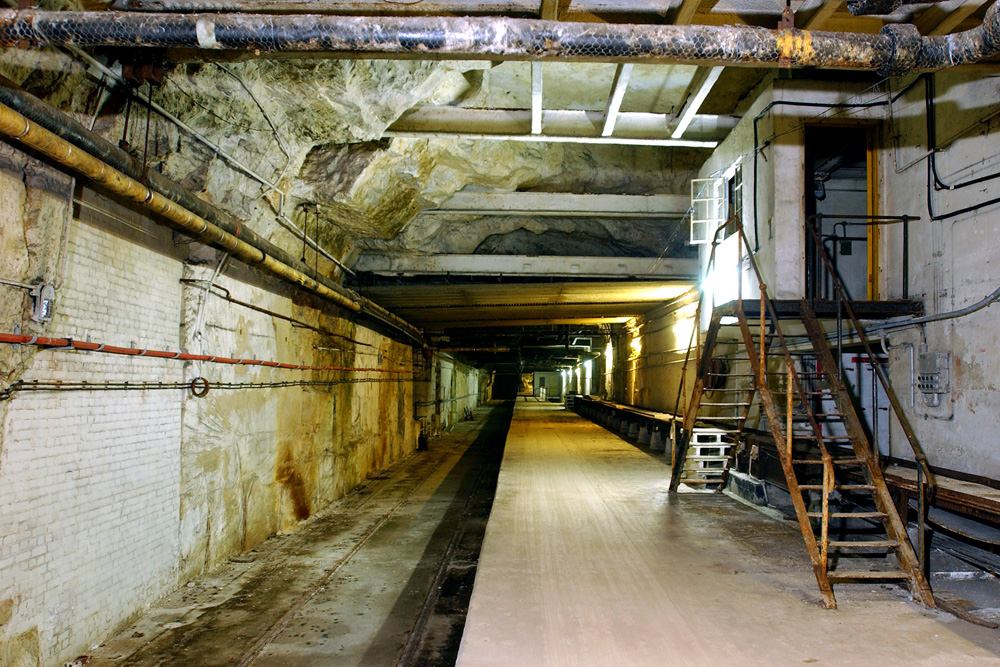
Photo: Crown Copyright
Each of the storage districts were approximately five acres in size and were numbered, 1 through to 11. However district number 1 was never converted due to a severe geological fault in the stone.
Once the threat of war passed, the ammunition store became surplus to requirements, and most of Tunnel Quarry has laid empty ever since,. But, the quarry is still strictly controlled by the MOD as several areas are still deemed to be top secret.
One of those areas is to the eastern end of Tunnel Quarry and it is this secure location, known as CCC, that Burlington Bunker acted as a decoy site for, drawing attention away from it for 12 years.
Advertisement ‐ Content Continues Below.
Corsham Computer Centre
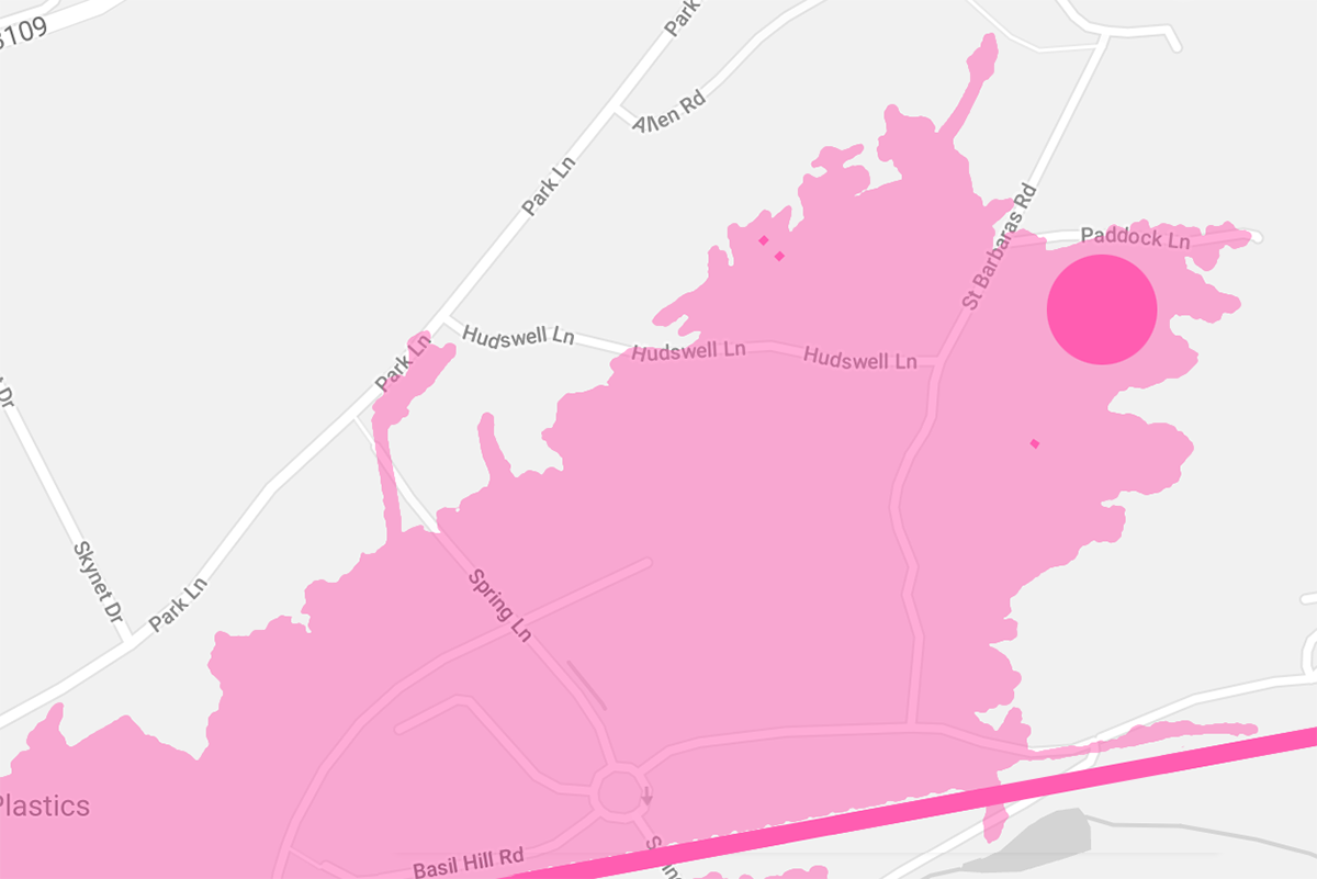
The Corsham Computer Centre (CCC) is to this day a classified government installation, constructed in the eastern end of Tunnel Quarry, an area the was once known as Hudswell Quarry.
Due to its active status, little is known about CCC other than the fact it was built in the 1980s in what was District 9 of the ammunition depot, it is sealed off from the rest of the quarry. It is only accessible via a lift from a discreet bunker-style entrance in Peel Circus.
It's most likely that the bunker was built in a part of District 9 which underwent additional work when it was originally converted. Unlike the rest of the ammunition depot, a series of parallel concrete walls were constructed and the intermittent stone removed. This district also has the highest ceiling in the depot, an average of 7.6 meters.
As this area was already cleared of stone, this would have allowed the construction team to build an open-plan, self contained bunker. The work involved the installation of supports for the old quarry ceiling and concrete reinforcement to ensure that the bunker needed as little maintenance as possible in future.
It was during the construction work when the Burlington decoy story came into play, during this time rumours were circulated that the work being carried out in the area was to upgrade Burlington.
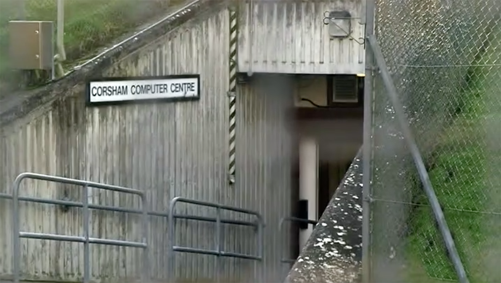
At first glance, security at the site appears to be low key, however two perimeter fences circle the entrance with a ring of dense vegetation and trees to obscure the facility from public view. The fence breaks for just one gate, which is watched over by several CCTV cameras.
Beyond the gate is a large mound of earth with a concrete-reinforced entrance that leads into the side of the artificial hill. Inside the hill, visitors are faced with a plain reception with staff protected behind a glass panel. Two "test tube" security doors lead to the bunker's personnel lift.
Some have claimed that the lift takes you to a plain, whitewashed corridor which circles the outside of a control room, revealing nothing more than a water cooler. There are tales of an open-plan, operations room beyond the corridor, with a wall of video displays and staff manning terminals 24/7.
According to the MOD, CCC is a data processing centre. Then-Secretary of State for Defence, Des Browne confirmed this in 2007. He described the bunker as a "data processing facility in support of Royal Navy operations".
UK parliamentary documentation reported that "work on software for Trident is carried out in the Corsham Computer Centre, also referred to as the Corsham Software Facility. This is an underground complex close to Basil Hill Barracks in Wiltshire."
This would suggest that CCC is part of the Submarine Command & Control (SMC2) programme, responsible for the maintenance of software linked to the UK's nuclear deterrent, the Trident programme.
Primary Network Control Centre
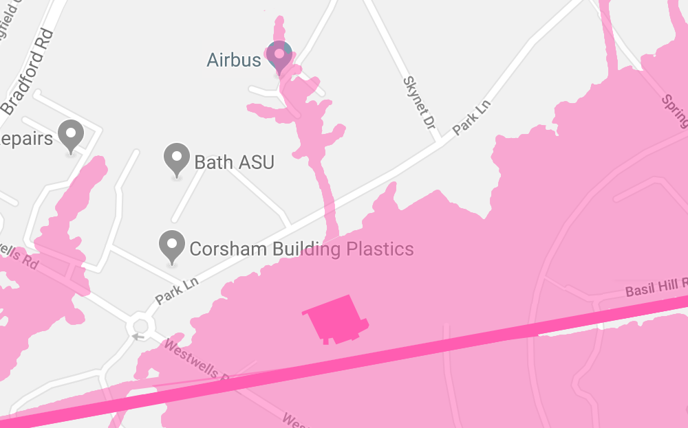
At the opposite end of Tunnel Quarry is the area which was originally intended to be District 1 of the ammunition depot. Despite the geological fault, in 1943 the Air Ministry carried out work to convert the area. Because of the fault running through this part of the quarry, the project was challenging.
Galleries from mining days had to be skilfully squared up and the floor graded. An electric lift from the surface was also installed for access, this lift is still used to this day.
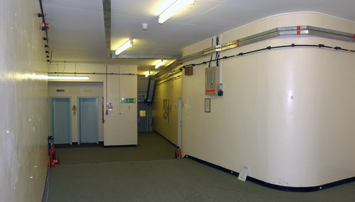
Photo: Crown Copyright
The conversion work gave approximately 30,000 square feet of office space and initially became the home of the South West Control, a military communications centre, housing communications switching equipment, telephone switch boards and teleprinter equipment.
The site later became known as the Primary Network Control Centre (PNCC) and it continued it's life as a military communication centre until it closed in the 1990s.
PNCC is still used to this day for military communications, it most likely falls under the umbrella of the GOSCC. The communications equipment was updated some time after 2008, which ties in with the multi-million pound redevelopment of the new GOSCC building.
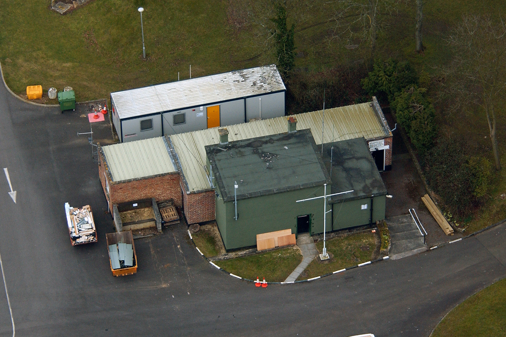
Photo: Crown Copyright
Near the GOSCC building, on the corner of Westwells Road and Park Lane, a small green building can be seen through the fences. This is the top of the 1943 lift shafts that lead directly into PNCC. These lifts are one of the main access routes into the underground complex today, as most of the other lifts in Spring Quarry, Tunnel Quarry and Burlington have been decommissioned. With the exception of Spring Park's lift which is a former goods elevator, and the lift at CCC.
The GOSCC surface building also houses the Cyber Policy Unit, which is responsible for protecting the British Army's essential systems and computer networks that allow servicemen to carry out their missions around the world. The surprisingly small crack team of technical staff is made up of people who understand MOD systems and their vulnerabilities. This team may also have a presence in PNCC.
Advertisement ‐ Content Continues Below.
Browns Quarry
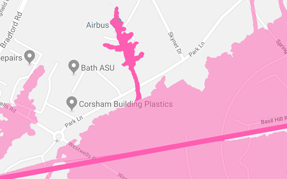
Moving out of Tunnel Quarry now and to another interesting underground location adjoining it on its northern edge. Browns was a small quarry, and while it was nothing to do with the ammunition depot, it was constructed by the Royal Engineers at the same time.
Browns Quarry underwent some of the most extensive and challenging changes of all the MOD quarries. An underground operations room was built as part of the RAF's Command Centre for No. 10 Group. The work called for the construction of two chambers, 15 meters square and 13 meters high, both with two mezzanine observation floors.
The walls of the operations room were finished in a special paint scheme consisting of greens and yellow, designed not to distract the operator. The control room centred around a plotting table, the controllers could monitor the progress of the enemy towards Britain from the two wooden mezzanine floors above.
The control room was responsible for nine fighter air fields in the West of England and Wales which were home to 19 squadrons using 113 aircraft. The group commander who sat in the gallery would scramble appropriate squadrons to intercept the enemy based on information given to him from fighter command headquarters at Bentley Priory in Stanmore, Middlesex.
In 1945 the room became a radar training centre and between 1951 and 1955 it was the Section Operations Centre for the United Kingdom Radar Air Defence System codenamed ROTOR, but by late 1955 the control functions had been moved elsewhere and the room was stripped of all of it's fittings.
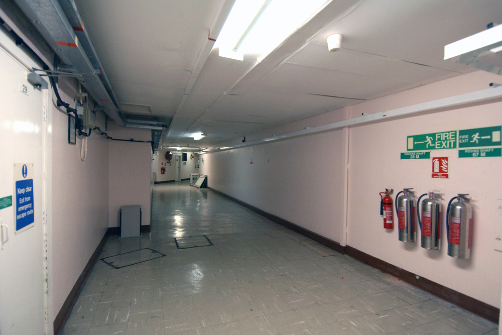
Photo: Crown Copyright
Later in life the quarry became part of the Command Defence Communications Network (CDCN). The bunker sits underneath Skynet Drive, where a modern building houses the hub of a hardened satellite communications network. The network primarily serves the UK armed forces, but also several other governments and organisations around the world.
The military coms network, also named Skynet, is now in its fifth generation and is operated out of Corsham by Airbus Defence & Space. The first of four Skynet 5 satellites was launched by an Ariane 5 rocket in 2007, and has been designed to support smaller, low powered, tactical terminals.
The satellites are nuclear hardened, have anti-jamming countermeasures and laser protection. They have fully steerable downlink spot beams, in order to direct secure and encrypted data uplink to British armed forces personnel deployed in places like Afghanistan and other parts of the world, including the Falklands, Cyprus and on ships at sea. The network is controlled from the CDCN building in Corsham, via satellite uplink located at nearby RAF Colerne.
As you can see in the photo above, which was released by the MOD in 2004, Browns Quarry appears to be in good condition underground. So, it's likely that the programme uses the underground space, as it's located directly beneath their control room and is accessible via a lift shaft, similar to the PNCC one, in the carpark.
For decades urban explorers and conspiracy theorists have dreamt of finding out exactly what happens underground at Corsham, or perhaps just getting a glimpse over the razor wire topped fences.
Now, thanks to the fact that consumer drones have become more affordable, for the first time ever we're able to get a high definition, bird's eye view of the Corsham site.
The video above starts as the drone hovers over the CDCN building on Skynet Drive in Corsham, before flying over the GOSCC building in Site 2. This gives us a good idea of what's going on from the air, but the underground tunnels of Corsham still hold plenty of secrets.
© Crown Copyright Notice: Images on this page are reproduced with the permission of the Controller of His Majesty’s Stationery Office.
Further Reading
Dive into the world of the paranormal and unexplained with books by Higgypop creator and writer Steve Higgins.
Investigating The Unexplained
Practical advice on conducting paranormal investigations and uncovering the unexplained.
Buy Now
Demystifying The Oracle
A balanced look at Ouija boards, exploring whether they are toys, tools, or dangerous occult devices.
Buy NowMore Like This
ConspiraciesDecember 22, 2024
'The Alien Perspective': The UFO Documentary That Challenges Everything

ConspiraciesDecember 18, 2024
Interview: James Fox's New Documentary 'The Program' Explores The "Unprecedented" Push For Disclosure
ConspiraciesOctober 22, 2024
Visiting The Location Of The Rendlesham Forest Incident
ConspiraciesOctober 09, 2024
Watch The Trailer For James Fox’s New UFO Documentary 'The Program'
 See More on Audible

Comments
Want To Join The Conversation?
Sign in or create an account to leave a comment.
Sign In
Create Account
Account Settings
Be the first to comment.